
Lidar Annotation Services
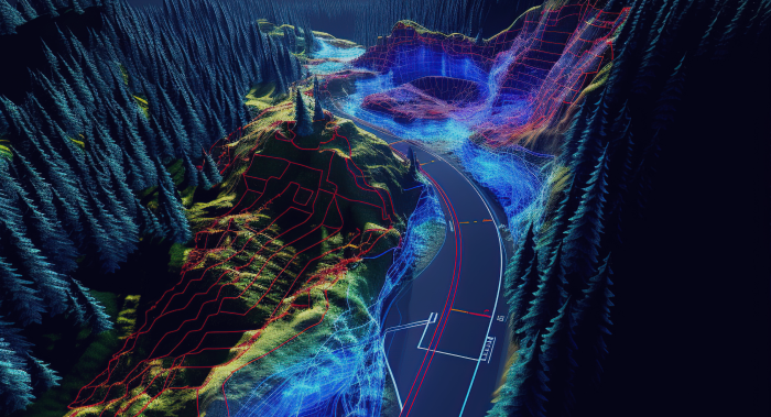
Unidata provides a comprehensive suite of services for precise LIDAR point cloud annotation, guaranteeing the creation of high-quality training datasets tailored for sophisticated machine learning applications. Our meticulous approach ensures that your datasets meet the specific requirements needed to enhance model performance and accuracy
24/7*
- 6+
- years experience with various projects
- 79%
- Extra growth for your company.
What is LIDAR Annotation?
LIDAR annotation is the process of labeling and tagging data derived from Light Detection and Ranging (LIDAR) technology to enhance the understanding and usability of three-dimensional spatial information. This involves marking various elements within LIDAR point clouds, such as terrain features, buildings, vegetation, and other significant structures, allowing for precise analysis and interpretation of the data.
LIDAR annotation is invaluable across numerous applications, including autonomous vehicle navigation, environmental monitoring, urban planning, and construction management.
How we deliver Lidar services
 Step 1
Consultation and Requirements
Our delivery of LiDAR annotation services begins with an initial consultation phase where we engage closely with the client to understand their specific needs, objectives, and expectations. During this consultation, we define the scope of the project, clarify the types of annotations required (such as 3D bounding boxes or semantic segmentation), and determine key factors like accuracy requirements, target objects, classes, and potential edge cases. It’s also during this phase that we discuss the end-use of the annotated data, whether for machine learning, simulations, or other purposes. This ensures that there is alignment on expectations before the project commences and sets the foundation for clear communication throughout the project. Step 2
Team and Roles Planning
Following the consultation, we begin the team and roles planning phase. At this point, we assemble a dedicated team tailored to the project’s needs. This includes assigning a project manager to oversee the entire process and act as the primary point of contact for the client. We also allocate highly skilled annotators with relevant experience in working with LiDAR datasets, ensuring they possess the technical expertise and domain knowledge required. Quality assurance personnel are assigned to verify the accuracy of the annotated data, and roles such as data engineers, tool specialists, and customer support are defined to facilitate the smooth execution of the project. Step 3
Tasks and Tools Planning
Once the team is established, we focus on planning the tasks and tools required for the project. We break down the project into specific tasks based on the agreed-upon scope and define their complexity and expected durations. Task assignment strategies are devised to ensure efficient processing, whether by batching data for parallel processing or by assigning specific object types to annotators with specialized expertise. During this phase, we also identify the most appropriate tools for the job, including cloud-based or local annotation platforms that support 3D point clouds. Step 4
Software Selection
The software selection phase is critical for the success of the project. We carefully choose software that is compatible with the client’s data formats, such as .LAS, .PCD, or .BIN, and offers features like 3D visualization, segmentation, and annotation tools. We also consider whether the software integrates smoothly with the client’s machine learning pipeline, particularly if real-time feedback is needed. Collaboration features for multi-user environments are essential in larger projects, and we also evaluate the software’s customizability to meet specific requirements, such as labeling niche objects or implementing client-specific workflows. The software we select is always reliable, scalable, and capable of handling large volumes of LiDAR data with high precision. Step 5
Project Stages and Timelines
With the software selected, we create a detailed project plan during the project stages and timelines phase. This plan outlines the entire project from start to finish, broken down into phases. Typically, these include an initial setup and calibration phase, annotation execution with defined milestones, a quality assurance and validation phase, and a final stage for data formatting and delivery. The timeline is shared with the client to ensure transparency, and regular progress updates are provided to maintain clear communication throughout the project. Step 6
Annotation Tasks Execution
During the annotation tasks execution phase, the annotation team begins working on the LiDAR data based on the guidelines established in the earlier phases. Annotators process the LiDAR data using the selected software, applying the necessary labels and annotations as per the client’s specifications. The project manager monitors the performance and progress of the team, ensuring that quality standards are upheld and that productivity targets are met. Throughout the execution, feedback loops between the annotation team and the project manager help ensure that the work remains aligned with the client’s objectives. Step 7
Quality and Validation Check
After the annotations are completed, the project moves into the quality and validation check phase. Here, the annotated data undergoes thorough validation by our quality assurance team, who use a combination of automated tools and manual reviews to check for consistency, accuracy, and correctness. This review ensures that annotations meet the defined specifications and are free from errors. Any inconsistencies or mistakes are rectified during this phase to guarantee that the final data meets the highest quality standards. Step 8
Data Preparation and Formatting
Once the data has passed the quality checks, we prepare it for delivery during the data preparation and formatting phase. The annotated data is converted into the required file formats, such as .json, .xml, or .csv, and is organized in a way that makes it easy for the client to integrate it into their machine learning pipelines or other systems. If necessary, we also compress and encrypt the data to ensure secure transfer. Step 9
Prepare Results for ML Tasks
In the prepare results for ML tasks phase, we ensure that the data is ready for machine learning applications. This involves structuring the data according to the client’s model training specifications and ensuring that annotations are consistent and accurate. We also include any necessary metadata, such as timestamps or camera synchronization data, to ensure seamless integration into the client’s workflows. Step 10
Transfer Results to Customer
Once the data is fully prepared, we transfer it to the client during the transfer results to customer phase. This is done securely using methods such as cloud-based transfer (via AWS, Google Cloud, or Azure), secure FTP, or physical delivery methods like external hard drives for particularly large datasets. We ensure that the delivery is smooth, secure, and in line with any confidentiality agreements established with the client.
Step 11
Customer Feedback
Finally, after the data has been delivered, we seek customer feedback to ensure satisfaction and identify any areas for improvement. We conduct a thorough review of the delivered data, discuss any necessary revisions or adjustments, and gather feedback on the overall process, communication, and quality of the work. Based on this feedback, we make any necessary changes to the data and incorporate client suggestions into our future workflows. This collaborative process helps us continually improve our services and build strong, long-lasting relationships with our clients.The best software for Lidar annotation tasks
Scale AI
Scale AI is a highly versatile platform known for its ability to handle complex annotation tasks, including LiDAR point clouds. It offers a variety of automation tools and is widely used in industries like autonomous driving and robotics.

Key Features:
- Advanced tools for 3D point cloud annotation, including segmentation and 3D bounding boxes.
- AI-powered automation to accelerate the annotation process.
- Real-time quality assurance to ensure accuracy.
- Scalable for large datasets with efficient task management.
Best For:
Enterprises and teams working on large-scale LiDAR projects requiring high-quality annotations for autonomous systems.
Labelbox
Labelbox is a comprehensive annotation platform designed to simplify the labeling process for LiDAR data. It integrates machine learning tools to assist with labeling and offers easy collaboration for team-based projects.

Key Features:
- Support for 3D point cloud annotation with flexible tooling.
- AI-driven suggestions to speed up manual annotation.
- AI-driven suggestions to speed up manual annotation.
- Rich data governance and security features.
Best For:
Teams that need a highly customizable annotation platform for managing LiDAR data and require collaboration features for large, multi-disciplinary teams.
CVAT (Computer Vision Annotation Tool)
CVAT is an open-source annotation tool known for its flexibility and ease of use in handling LiDAR data. It’s designed for computer vision tasks and is favored by researchers and companies that need a reliable tool for 3D data labeling.

Key Features:
- Support for 3D point clouds, as well as 2D and video annotations.
- Open-source with full control over customization.
- Integrated automation tools to reduce manual effort.
- Suitable for small and large datasets alike.
Best For:
Companies or research teams that want an open-source, flexible tool for custom LiDAR annotation needs.
CloudAnnotation
CloudAnnotation is a cloud-based annotation tool with support for both 2D and 3D data, including LiDAR point clouds. It provides a simple interface, making it easy to manage and annotate complex data sets efficiently.

Key Features:
- Support for 3D LiDAR annotation, including point cloud segmentation and object detection.
- Web-based interface for easy accessibility and collaboration.
- Automated tools to assist with repetitive annotation tasks.
- Built-in version control and data management.
Best For:
Small to medium-sized teams that need an accessible and user-friendly LiDAR annotation tool in the cloud.
3D Point Studio by Voxel51
Voxel51's 3D Point Studio is a specialized platform for annotating LiDAR data, focusing on providing powerful visualization and segmentation tools for handling 3D point clouds in various applications like autonomous driving and robotics.
Key Features:
- Intuitive 3D visualization tools for precise point cloud annotation.
- Rich support for object segmentation, labeling, and tracking.
- AI-assisted workflows to enhance annotation accuracy and speed.
- Collaboration tools to manage teams and large-scale datasets.
Best For:
Teams working on autonomous driving or robotics who need advanced 3D visualization and annotation tools.
VoTT (Visual Object Tagging Tool)
VoTT is an open-source annotation tool developed by Microsoft that supports various data formats, including 3D point clouds. It is ideal for teams looking for a free, customizable option for annotating LiDAR data.

Key Features:
- Support for 3D and 2D annotations, including point cloud data.
- Extensible and customizable for different types of annotation workflows.
- Integrates with popular machine learning frameworks for seamless model training.
- Lightweight tool suitable for both small and large-scale projects.
Best For:
Small teams or individual users looking for a free, open-source solution with solid support for LiDAR annotations.
Scaleit
Scaleit is a LiDAR annotation platform designed specifically for large-scale projects, offering advanced tools for handling complex 3D data. It includes high levels of automation, making it ideal for enterprises dealing with extensive point cloud data.

Key Features:
- Full support for 3D point clouds, including bounding boxes, segmentation, and more.
- Automation tools that significantly reduce manual annotation time.
- Collaboration and project management tools to handle large teams and datasets.
- Seamless integration with cloud storage and machine learning pipelines.
Best For:
Large-scale projects with high volumes of LiDAR data, particularly for enterprises in the autonomous vehicle industry.
Types (forms) of Lidar annotation services

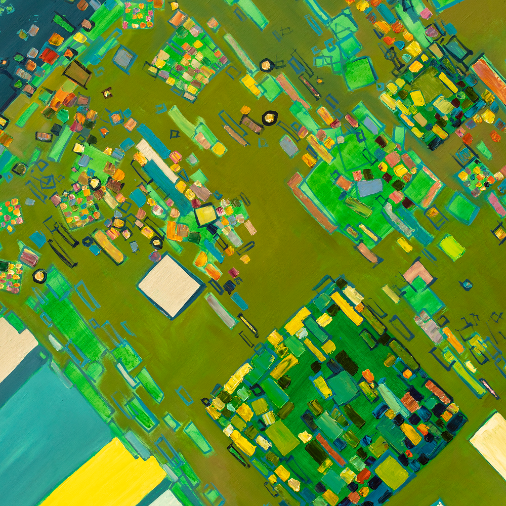
3D Bounding Box Annotation
This form of annotation involves drawing 3D boxes around objects in LiDAR point clouds. It is used to define the spatial dimensions of objects like vehicles, pedestrians, buildings, or other objects of interest. This is especially important in autonomous driving, robotics, and other applications requiring object detection and classification.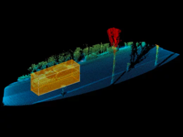
Semantic Segmentation
Semantic segmentation is the process of classifying each individual point in a LiDAR point cloud into specific categories or classes. For example, points can be labeled as road surfaces, vehicles, trees, pedestrians, buildings, etc. This type of annotation is used for tasks like scene understanding, environmental mapping, and smart city planning.
Instance Segmentation
Instance segmentation is similar to semantic segmentation but involves identifying individual instances of objects within a scene. Instead of labeling all vehicles as "car," for example, each individual vehicle is labeled as a separate instance. This is useful for scenarios that require tracking and identifying multiple objects separately, such as autonomous vehicle navigation.
Polyline Annotation
Polyline annotation involves drawing lines to represent road lanes, boundaries, or paths within a LiDAR point cloud. This type of annotation is crucial for mapping road networks, lane marking detection in autonomous vehicles, and infrastructure planning for smart cities.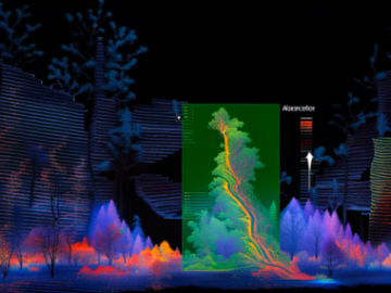
Point Annotation
Point annotation is used to mark specific key points of interest within a LiDAR point cloud. It can be used to pinpoint landmarks, track critical object locations, or identify specific areas within a larger dataset. This is often used in applications where exact locations of key features are required, such as in environmental monitoring and construction.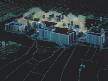
2D Projection from 3D Point Clouds
This type of annotation involves projecting 3D LiDAR point cloud data onto 2D images to enable 2D labeling. It combines the spatial accuracy of LiDAR data with the simplicity of 2D image annotation, typically used in cases where the user wants to combine visual and LiDAR information for enhanced perception.
Cuboid Annotation
Similar to 3D bounding boxes, cuboid annotation focuses on identifying and labeling objects with cuboids that account for the depth, width, and height of the object. It’s often used to label vehicles, pedestrians, and other objects in complex 3D spaces, providing rich data for 3D object detection models.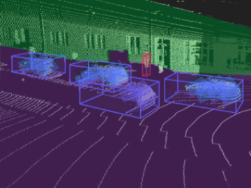
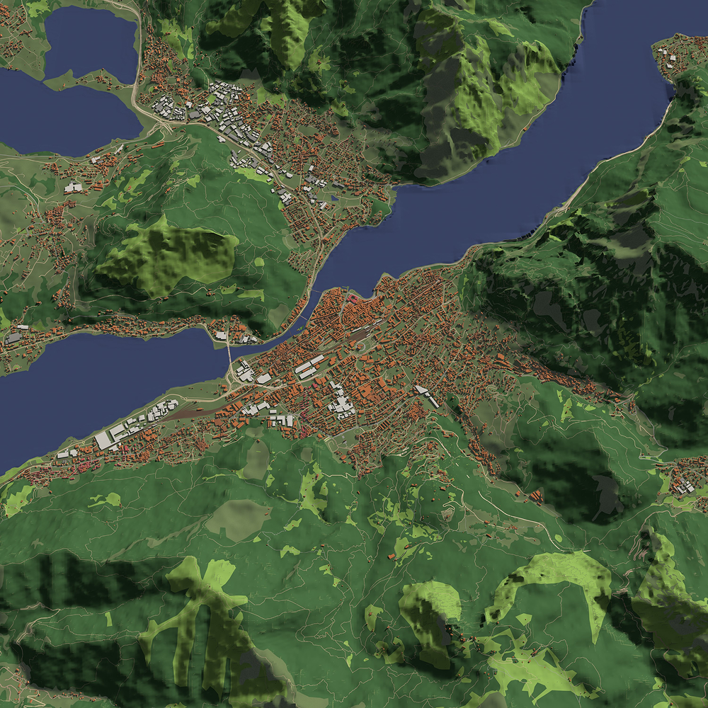
Environmental Object Annotation
Environmental object annotation involves labeling non-dynamic elements within a LiDAR point cloud, such as buildings, trees, fences, or roads. This form of annotation is used in applications like city planning, infrastructure development, and environmental monitoring, where a detailed understanding of static surroundings is crucial.3D Object Tracking
This type of annotation involves labeling objects across multiple frames to track their movement through space. It is especially important in scenarios such as autonomous driving, where continuous tracking of vehicles, pedestrians, and other objects is essential for decision-making and navigation.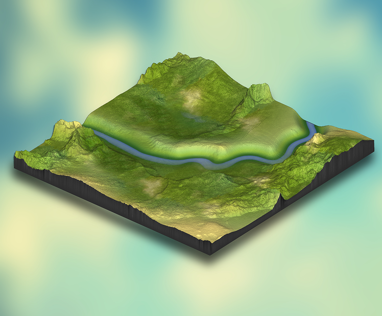
Terrain and Elevation Annotation
This form of annotation focuses on labeling elevation and terrain-related data, which can include hills, valleys, cliffs, and other geographical features. It is often used in topographical mapping, surveying, and environmental monitoring.Lidar Annotation Use Cases
-
 01
01Construction & Architecture
In construction and architecture, LiDAR annotation is used to create accurate 3D models of buildings, construction sites, and infrastructures. By labeling point clouds with information about building materials, dimensions, and structural components, AI can assist in the planning, design, and monitoring of construction projects. LiDAR data also helps with site inspections and ensures that designs meet building codes and specifications. -
 02
02Environmental Monitoring
In environmental monitoring, this service is used to analyze changes in landscapes, forests, or coastal regions. By labeling point clouds of terrain or vegetation, AI can track environmental changes, such as deforestation, erosion, or flood risks. Annotated LiDAR data helps in assessing the impact of climate change, supporting conservation efforts, and improving environmental management strategies. -
 03
03Healthcare
LiDAR labeling helps to create 3D models for medical imaging, such as MRI or CT scans. By annotating data from 3D scans of organs, bones, or tissues, AI systems can assist doctors in diagnosing conditions like tumors, fractures, and abnormal growths. LiDAR-based models allow for more accurate visualization of complex structures, enabling precise surgical planning and better patient care. -
 04
04Agriculture
In agriculture, Light Detection and Ranging annotation help monitor land and crop conditions by creating detailed 3D maps of fields. By annotating areas affected by pests, diseases, or irregularities in soil, AI can analyze crop health and optimize farming practices. LiDAR data helps farmers identify areas that need attention, enabling more efficient use of resources such as water, fertilizer, and pesticides. -
 05
05Real Estate
LiDAR annotation in real estate is used to create 3D models of properties and land. By labeling LiDAR data with attributes such as the size of rooms, location of amenities, and the layout of properties, AI can enhance property listings and improve virtual tours. This data also helps developers and buyers visualize spaces more accurately, aiding in better decision-making when purchasing or designing properties. -
 06
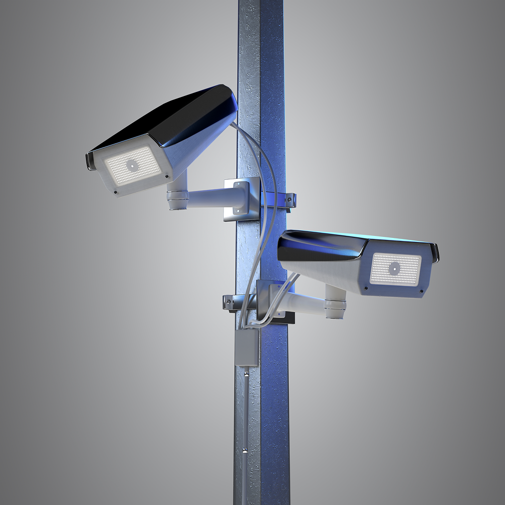
06Security & Surveillance
It is used to improve monitoring systems by labeling 3D data from surveillance areas. By annotating LiDAR point clouds with information about objects like vehicles, people, or restricted zones, AI can better track movements and detect potential security threats. This helps security teams monitor large areas in real time, improving situational awareness and response times. -
 07
07Manufacturing
This service helps in manufacturing for quality control and warehouse management. By annotating 3D scans of products, machines, or production lines, AI systems can detect defects, misalignments, or wear and tear. LiDAR data also helps in optimizing layout planning for factories or warehouses, ensuring better organization and more efficient workflows. -
 08
08Automotive (Autonomous Vehicles)
LiDAR annotation is essential for autonomous vehicles to understand their surroundings. By annotating LiDAR point clouds with labels for objects such as pedestrians, vehicles, traffic signs, and road markings, AI systems can accurately perceive the environment in 3D. This data helps autonomous vehicles navigate safely, detect obstacles, and make real-time driving decisions, ensuring safer travel.
How It Works: Our Process
A Clear, Controlled Workflow From Brief to Delivery


Lidar Annotation Cases

Digital Tree Passport Annotation for Forest Mapping
- Forestry Monitoring & GIS
- 200,000 trees, 10 species classes
- 2 months
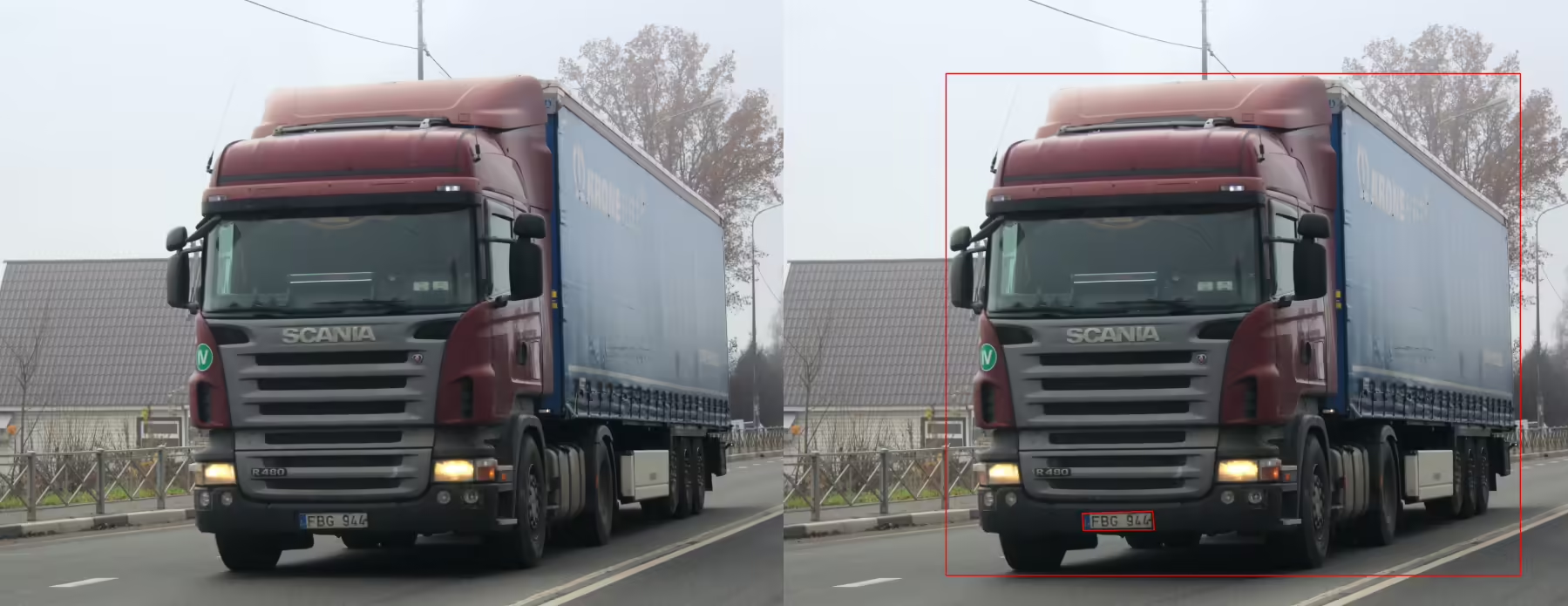
License Plate Annotation for Vehicle Recognition System
- 100,000 images with detailed license plate markup (bounding boxes, digits, regional symbols)
- 2 weeks
Sentiment Annotation for Brand Monitoring
- Marketing & Consumer Insights
- 12,000 text samples, 3 sentiment classes (positive, negative, neutral)
- 3 weeks

Surveillance Video Annotation for Entrance Monitoring
- Surveillance & Security
- 90 minutes of video from three cameras, approximately 50-60 thousand frames
- 2 week
Why Companies Trust Unidata’s Services for ML/AI
Share your project requirements, we handle the rest. Every service is tailored, executed, and compliance-ready, so you can focus on strategy and growth, not operations.
What our clients are saying

UniData

Data purchase
Our team got in touch with UniData for purchasing video data. The team at UniData was transparent, timely, and pleasant to communicate and negotiate with. Their samples and descriptions aligned well with the data we received. We will certainly reach out to UniData again if we're in search of 3rd party video data.

Data is well organized and easy to…
Data is well organized and easy to consume. We could download and use it for training within few hours of receiving the data links.
Other Services
Ready-Made Datasets
Get our ready-made datasets to enhance the quality of your models and improve testing

Data Collection
Collect and enhance diverse image, video, text, and audio data for your business

Data Annotation
Get accurate data labeling and annotation for your machine learning projects

LLM Training Services
Comprehensive data services for training, evaluation, and testing of LLM models across 12 industries

Ready to get started?
Tell us what you need — we’ll reply within 24h with a free estimate

- Andrew
- Head of Client Success
— I'll guide you through every step, from your first
message to full project delivery
Thank you for your
message
We use cookies to enhance your experience, personalize content, ads, and analyze traffic. By clicking 'Accept All', you agree to our Cookie Policy.