---
title: "3D Point Cloud"
description: "Annotation Vs Labeling Tasks 3D Point Cloud Data Annotation3D Point Cloud Data LabelingDefinitionPrecise marking of individual points, objects, and surfaces within 3D point cloud data,…"
url: "https://unidata.pro/data-annotation/3d-point-cloud/"
date_modified: "2026-06-16T16:59:51+03:00"
language: "ru-RU"
---
Annotation Vs Labeling Tasks
----------------------------
| | **3D Point Cloud Data Annotation** | **3D Point Cloud Data Labeling** |
|---|---|---|
| **Definition** | Precise marking of individual points, objects, and surfaces within 3D point cloud data, including geometric boundaries, semantic classification per point, and spatial relationships | Assigning classification labels to entire point cloud clusters, scenes, or simple object presence without detailed point-level precision |
| **Annotation Depth** | Comprehensive: processes every point in the cloud, captures fine geometric details, identifies occlusions, maps object relationships, and maintains temporal consistency across sequential frames | Selective: processes at cluster or scene level, captures only object categories or scene types without point-level detail, and treats frames independently without temporal linkage |
| **Common Tasks** | • Point-wise semantic segmentation • 3D bounding cuboids around objects • Instance segmentation in point clouds • Surface normal estimation marking • Object pose and orientation annotation • Occlusion boundary identification • Scene completion annotation • Multi-object tracking across sweeps • Free space vs. occupied space marking • Ground plane segmentation | • Object-level classification (car/truck/pedestrian/cyclist) • Scene type classification (intersection/highway/parking lot) • Simple object presence/absence detection • Cluster-level categorization • Weather/lighting condition tagging • Basic obstacle vs. non-obstacle labeling • Zone-based occupancy counting |
| **Complexity Level** | Extremely high complexity: requires deep understanding of 3D geometry, sensor characteristics, point cloud density variations, occlusion patterns, and temporal consistency across frames | Medium complexity: requires basic point cloud interpretation skills and ability to identify objects in 3D space without fine-grained segmentation |
| **ML Impact** | Enables: autonomous driving perception systems, robotics navigation, environment reconstruction, precise obstacle detection and tracking, sensor fusion models, 3D scene understanding | Enables: coarse object detection, scene classification, basic environment monitoring, traffic flow analysis, occupancy estimation |
## Block: Hero
**Title:** 3D Point Cloud Services **Description:** Unidata provides advanced 3D point cloud annotation services, specializing in meticulous labeling and tagging of 3D point cloud data to significantly improve object detection, scene understanding, and spatial analysis across a wide range of industries and applications. **Button 2:** Invite to tender **Button-link 2:** #
## Block: Text block
**Title:** What is 3D Point Cloud Annotation? **Description:** 3D point cloud annotation is the process of labeling and tagging data collected from three-dimensional point clouds, which are representations of physical objects and environments created through technologies such as LIDAR, laser scanning, or photogrammetry. This specialized annotation involves identifying and marking key features, objects, and spatial relationships within the point cloud to enhance the understanding and interpretation of three-dimensional structures. **Description second:** By providing precise annotations—such as bounding boxes, semantic labels, and key points—3D point cloud annotation supports various applications, including autonomous vehicle navigation, robotics, urban planning, and virtual reality. **Изображение в левую часть:** 
## Block: Services
**Block title:** Types of 3d point cloud annotation services **Block items:**
- **Title:** 3D Bounding Box Annotation — **Image:**  — **Description:** This type of annotation involves drawing 3D bounding boxes around objects in a point cloud to define their spatial boundaries. Each box captures the height, width, and depth of the object, helping in object detection and classification tasks.
- **Title:** 3D Semantic Segmentation — **Image:**  — **Description:** In 3D semantic segmentation, each point in the point cloud is labeled with a class corresponding to the object or surface it represents. This type of annotation is used to classify different parts of the environment or objects within a 3D space.
- **Title:** 3D Instance Segmentation — **Image:**  — **Description:** Similar to semantic segmentation, instance segmentation goes further by not only labeling each point but also distinguishing between different instances of the same object class within a point cloud. Each instance is uniquely identified.
- **Title:** 3D Object Tracking — **Image:**  — **Description:** 3D object tracking involves identifying and following the movement of objects across multiple frames in a sequence of point clouds. This form of annotation tracks the object's position, orientation, and trajectory in 3D space.
- **Title:** 3D Keypoint Annotation — **Image:**  — **Description:** 3D keypoint annotation involves marking specific points of interest on objects within a point cloud, such as corners, edges, or joints. These keypoints help in understanding the geometry and structure of objects in 3D space.
- **Title:** 3D Lane and Road Marking Annotation — **Image:**  — **Description:** This annotation type is specifically used for marking lanes, road boundaries, and other relevant features in point clouds captured by LiDAR or other 3D sensors. It helps autonomous vehicles in navigating roads safely.
- **Title:** 3D Plane and Surface Annotation — **Image:**  — **Description:** In this form of annotation, planar surfaces and other geometric shapes within a point cloud are identified and labeled. This can include walls, floors, and other large surfaces within a 3D environment.
- **Title:** 3D Volume Annotation — **Image:**  — **Description:** Volume annotation involves labeling volumetric regions within a point cloud. This is particularly useful in applications where understanding the full 3D shape and volume of objects or regions is important.
- **Title:** 3D Object Classification — **Image:**  — **Description:** 3D object classification involves labeling objects within a point cloud with specific classes. This type of annotation helps in recognizing and categorizing different objects based on their geometric shape and spatial orientation.
- **Title:** 3D Environment Mapping — **Image:**  — **Description:** Environment mapping annotation is used to label and map out entire 3D environments within a point cloud, such as indoor spaces, urban areas, or natural landscapes. This helps in creating detailed 3D maps for navigation and simulation.
## Заголовок секции
3D Point Cloud Use Cases
## image case
- **image_case__repeater__image:**  — **Заголовок:** Healthcare — **Основной текст:** In healthcare, 3D Point Cloud services are used for reconstructing anatomical models from CT scans or MRIs, providing detailed visualizations of organs and tissues. By converting medical imaging data into 3D Point Clouds, AI can assist in planning surgeries, diagnosing conditions, and monitoring patient recovery. The high-resolution data allows for more precise treatment decisions, improving patient care and surgical outcomes.
- **image_case__repeater__image:**  — **Заголовок:** Automotive (Autonomous Vehicles) — **Основной текст:** In the automotive industry, these services are essential for developing autonomous vehicles. By processing data from LiDAR and other sensors, AI can generate 3D Point Clouds that map the surrounding environment, including pedestrians, vehicles, and obstacles. These Point Clouds help AI systems navigate complex road environments, improving vehicle safety and decision-making in real-time, and allowing self-driving cars to avoid accidents.
- **image_case__repeater__image:**  — **Заголовок:** Construction & Architecture — **Основной текст:** In construction and architecture, it helps create accurate 3D models of buildings, construction sites, and infrastructure. By scanning physical structures with LiDAR, architects, and engineers can generate detailed Point Clouds that assist in planning, designing, and modifying buildings. These models ensure that construction projects adhere to specifications, improve planning, and enable more effective management of resources.
- **image_case__repeater__image:**  — **Заголовок:** Agriculture — **Основной текст:** In agriculture, 3D Point Cloud solutions help monitor crop health and land conditions by converting aerial images from drones or satellites into 3D Point Clouds. These Point Clouds provide a comprehensive view of fields, helping farmers assess the health of crops, detect diseases, and optimize irrigation systems. 3D models allow farmers to make data-driven decisions to improve crop yield, reduce resource waste, and manage farmland more efficiently.
- **image_case__repeater__image:**  — **Заголовок:** Real Estate — **Основной текст:** This technique is used to generate virtual property tours and detailed models of buildings. By capturing 3D data of properties, real estate agents can provide prospective buyers with immersive experiences, allowing them to explore homes remotely. 3D Point Clouds also assist in urban planning and architectural design, helping developers visualize the spatial layout of properties and surrounding areas.
- **image_case__repeater__image:**  — **Заголовок:** Security & Surveillance — **Основной текст:** In security and surveillance, these 3D services help generate detailed 3D models of environments, enhancing threat detection and monitoring. By scanning areas such as airports, stadiums, or industrial sites with LiDAR, AI systems can create Point Clouds that help security teams track movements and analyze potential threats. This technology improves real-time monitoring and response, providing more accurate and detailed surveillance footage.
- **image_case__repeater__image:**  — **Заголовок:** Manufacturing — **Основной текст:** Point Cloud is employed for quality control and equipment maintenance. By scanning products or machinery with LiDAR, manufacturers can create 3D Point Clouds that detect defects or wear and tear. This enables AI systems to identify production issues, automate inspection processes, and predict when machines will need maintenance, leading to improved product quality and minimized downtime.
- **image_case__repeater__image:**  — **Заголовок:** Entertainment & Media — **Основной текст:** 3D Point Cloud services help create realistic 3D models for movies, video games, and virtual reality (VR) environments. By capturing real-world objects or scenes in high detail, AI can use Point Clouds to generate digital replicas for CGI (computer-generated imagery) and immersive experiences. 3D Point Cloud data enhances the realism of visual effects, making content more engaging for audiences.
- **image_case__repeater__image:**  — **Заголовок:** Aerospace — **Основной текст:** In aerospace, it is used to map and model aircraft and spacecraft components. By scanning parts of aircraft with LiDAR or laser scanning technology, engineers can create accurate 3D models to improve design, monitor wear, and ensure safety. 3D Point Clouds also assist in the inspection and maintenance of aircraft, ensuring that parts meet safety standards and performance requirements.
- **image_case__repeater__image:**  — **Заголовок:** Energy & Utilities — **Основной текст:** In the energy and utilities sector, these services are employed for creating detailed models of infrastructure such as power plants, pipelines, and electrical grids. By scanning energy facilities with LiDAR, AI systems can generate 3D Point Clouds that help with inspections, monitoring, and maintenance. These models enable predictive maintenance, improve facility management, and ensure the efficient operation of energy infrastructure.
## section_title
How we deliver 3d point cloud services
## Content for section deliver data annotation services
- **Заголовок слайда:** Consultation and Requirements — **Описание слайда:** Our 3D point cloud annotation process begins with an in-depth consultation to understand your project’s specific needs. We discuss the objectives, such as the types of objects to be annotated, the level of detail required, and any specific challenges associated with the 3D data. We also gather information on the intended use of the annotations, whether for autonomous driving, robotics, or other applications. During this stage, we ensure that we fully understand your requirements, including project scope, timeline, budget, and any necessary compliance or confidentiality considerations. — **Картинка слайда:** 
- **Заголовок слайда:** Team and Roles Planning — **Описание слайда:** Based on the complexity and scale of your project, we assemble a specialized team with expertise in 3D point cloud annotation. This team typically includes experienced 3D annotators, quality assurance specialists, project managers, and technical consultants if needed. Each team member’s role is clearly defined, ensuring that all aspects of the annotation process are covered efficiently. We also establish a communication plan to keep you updated on progress and to facilitate quick resolutions to any challenges that may arise. — **Картинка слайда:** 
- **Заголовок слайда:** Tasks and Tools Planning — **Описание слайда:** In this stage, we outline the specific tasks required for your project, including the types of annotations needed (e.g., 3D bounding boxes, segmentation, object tracking). We plan the workflow to optimize the annotation process, identifying opportunities for automation where applicable. This detailed task planning helps ensure that the project is executed efficiently, meeting your deadlines and quality standards. — **Картинка слайда:** 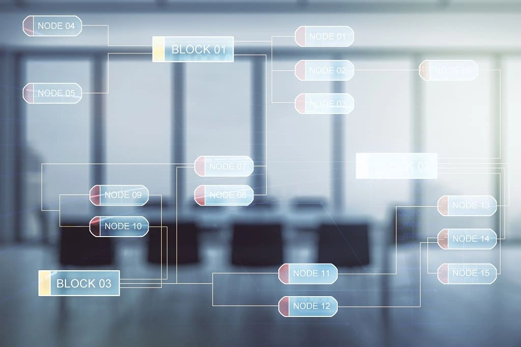
- **Заголовок слайда:** Software Selection — **Описание слайда:** Selecting the right software is critical for effective 3D point cloud annotation. We evaluate various platforms based on your project’s specific requirements, such as support for large point cloud datasets, ease of use, and integration capabilities. We might choose tools like SuperAnnotate, CVAT, or specialized 3D point cloud annotation software that offer the features needed for your project. If necessary, we customize the software to better suit your unique needs, ensuring that it facilitates a smooth and efficient annotation process. — **Картинка слайда:** 
- **Заголовок слайда:** Project Stages and Timelines — **Описание слайда:** We break down the project into manageable stages, each with clearly defined milestones and deadlines. These stages typically include initial setup, pilot testing, full-scale annotation, and final delivery. We create a detailed timeline that outlines the expected duration for each stage, allowing us to monitor progress and make adjustments as needed. Regular status updates are provided to keep you informed throughout the project. — **Картинка слайда:** 
- **Заголовок слайда:** Annotation Tasks Execution — **Описание слайда:** With the planning complete, our team begins the 3D point cloud annotation process. Annotators follow the guidelines established during the planning phase, using the selected tools and software to ensure precision and consistency. Whether it’s annotating objects in a large point cloud dataset or segmenting regions of interest, our team works diligently to meet the project’s requirements. Project managers oversee this phase closely, addressing any issues promptly to maintain the highest standards of quality. — **Картинка слайда:** 
- **Заголовок слайда:** Quality and Validation Check — **Описание слайда:** Quality assurance is a critical component of our 3D point cloud annotation services. We implement a multi-tiered validation process to ensure that the annotations meet the highest standards of accuracy and consistency. This includes automated checks where possible, supplemented by manual reviews from our quality assurance team. We also perform inter-annotator agreement (IAA) checks to ensure consistency across different annotators, which is essential for maintaining high-quality standards in complex 3D data. — **Картинка слайда:** 
- **Заголовок слайда:** Data Preparation and Formatting — **Описание слайда:** Once the annotations have been validated, we prepare the data for integration into your machine learning models. This involves formatting the annotated 3D data according to your specific requirements, such as converting it into compatible formats, organizing it into directories, or labeling it according to your system’s standards. We ensure that the data is clean, well-organized, and ready for immediate use without further processing. — **Картинка слайда:** 
- **Заголовок слайда:** Prepare Results for ML Tasks — **Описание слайда:** The finalized annotated 3D point cloud data is now ready to be used in your machine learning tasks. We ensure that the data is structured to maximize its utility in training, testing, and validating your models. This may include organizing the data into training and validation sets, normalizing the annotations, or applying any other preprocessing steps required by your machine learning framework. Our goal is to deliver data that enhances the performance and accuracy of your models, ensuring that it is ready for immediate use in your ML pipeline. — **Картинка слайда:** 
- **Заголовок слайда:** Transfer Results to Customer — **Описание слайда:** After thorough validation and preparation, we securely transfer the annotated 3D point cloud data to you. Depending on your preferences and security requirements, this can be done through cloud storage, secure FTP, or direct integration into your systems. We ensure that all files are delivered as agreed and provide any necessary documentation or support to help you integrate the data into your workflows. If needed, we offer post-delivery support to address any issues or questions you might have. — **Картинка слайда:** 
- **Заголовок слайда:** Customer Feedback — **Описание слайда:** Following the delivery of the annotated data, we actively seek your feedback to ensure that the results meet your expectations. We are committed to continuous improvement and value your input in refining our processes. If any adjustments are needed, we promptly address them to your satisfaction. This stage also serves as an opportunity to discuss potential future projects and explore how we can continue to support your 3D annotation needs. — **Картинка слайда:** 
## Заголовок секции Software
Software We Use
## Слайдер software
- **Заголовок левая часть:** SuperAnnotate — **Текст под заголовком в левой части:** SuperAnnotate is a robust annotation platform that offers advanced tools for both 2D and 3D data annotation. It excels in handling complex 3D point cloud datasets with high precision and efficiency, making it ideal for projects that require detailed annotation. — **Изображение в левой части:**  — **Перечисление ключевых функций:**
- **тезис:** Supports 3D point cloud annotation, including 3D bounding boxes and segmentation.
- **тезис:** AI-assisted tools for accelerating annotation workflows.
- **тезис:** Collaboration tools for managing large teams and complex projects.
- **тезис:** Integration with popular machine learning frameworks and cloud storage solutions. — **Заголовок под перечнем ключевых функций:** Best For: — **Техт под заголовком (Best For:):** Teams needing a powerful, AI-assisted platform for managing and annotating complex 3D point cloud data in large-scale projects.
- **Заголовок левая часть:** Labelbox — **Текст под заголовком в левой части:** Labelbox is a versatile annotation platform that extends its capabilities to 3D data, including point clouds. It offers comprehensive tools for managing and annotating 3D data, combined with strong project management and collaboration features. — **Изображение в левой части:**  — **Перечисление ключевых функций:**
- **тезис:** AI-powered tools for 3D point cloud segmentation and object classification.
- **тезис:** Supports various 3D annotation types, including 3D bounding boxes and instance segmentation.
- **тезис:** Integrated project management features for tracking progress and team collaboration.
- **тезис:** API support for seamless integration with machine learning pipelines. — **Заголовок под перечнем ключевых функций:** Best For: — **Техт под заголовком (Best For:):** Enterprises and teams seeking a scalable solution for managing and annotating 3D point cloud data with robust project management capabilities.
- **Заголовок левая часть:** CVAT (Computer Vision Annotation Tool) — **Текст под заголовком в левой части:** CVAT is an open-source annotation tool developed by Intel that supports a wide variety of annotation tasks, including 3D point cloud annotation. It is known for its flexibility and customizability, making it ideal for detailed and specialized 3D annotation projects. — **Изображение в левой части:**  — **Перечисление ключевых функций:**
- **тезис:** Supports 3D point cloud annotation, including 3D bounding boxes and segmentation.
- **тезис:** Customizable interface with scripting capabilities for specialized tasks.
- **тезис:** Free and open-source, with active community support.
- **тезис:** Suitable for handling large datasets with complex annotation requirements. — **Заголовок под перечнем ключевых функций:** Best For: — **Техт под заголовком (Best For:):** Developers and researchers who need a customizable, open-source tool for detailed 3D point cloud annotation tasks.
- **Заголовок левая часть:** CloudCompare — **Текст под заголовком в левой части:** CloudCompare is an open-source 3D point cloud processing software that includes robust annotation capabilities. It is particularly well-suited for handling large point cloud datasets and offers a range of tools for both basic and advanced annotation tasks. — **Изображение в левой части:**  — **Перечисление ключевых функций:**
- **тезис:** Supports 3D point cloud annotation, including segmentation and point labeling.
- **тезис:** Advanced point cloud processing tools for cleaning, filtering, and analyzing data.
- **тезис:** Free and open-source, with extensive documentation and plugin support.
- **тезис:** Handles large datasets efficiently, making it ideal for projects requiring detailed 3D analysis. — **Заголовок под перечнем ключевых функций:** Best For: — **Техт под заголовком (Best For:):** Teams and individuals needing a powerful, open-source tool for comprehensive 3D point cloud processing and annotation.
- **Заголовок левая часть:** 3D Slicer — **Текст под заголовком в левой части:** 3D Slicer is an open-source software platform primarily used for medical imaging, but it also supports robust 3D point cloud annotation capabilities. It is particularly strong in handling volumetric data and is widely used in medical and research applications. — **Изображение в левой части:**  — **Перечисление ключевых функций:**
- **тезис:** Supports 3D point cloud annotation, including volumetric segmentation and landmark labeling.
- **тезис:** Extensive tools for medical imaging data, including CT, MRI, and ultrasound.
- **тезис:** Open-source with a large user community and comprehensive documentation.
- **тезис:** Customizable with a wide range of plugins and extensions. — **Заголовок под перечнем ключевых функций:** Best For: — **Техт под заголовком (Best For:):** Medical researchers and professionals requiring advanced tools for annotating and analyzing 3D point cloud data, particularly in healthcare applications.
- **Заголовок левая часть:** VoTT (Visual Object Tagging Tool) — **Текст под заголовком в левой части:** VoTT by Microsoft is an open-source annotation tool that supports both 2D and 3D data. While primarily known for 2D annotations, it also provides capabilities for annotating 3D point clouds, making it a versatile option for teams working with mixed data types. — **Изображение в левой части:**  — **Перечисление ключевых функций:**
- **тезис:** Supports 3D point cloud annotation, including 3D bounding boxes and object classification.
- **тезис:** Integration with Azure ML and other cloud services for seamless data processing.
- **тезис:** User-friendly interface that simplifies the annotation process.
- **тезис:** Free and open-source, with active community support. — **Заголовок под перечнем ключевых функций:** Best For: — **Техт под заголовком (Best For:):** Teams needing a flexible tool that can handle both 2D and 3D annotation tasks, particularly those integrating with Microsoft Azure services.
- **Заголовок левая часть:** Scalabel — **Текст под заголовком в левой части:** Scalabel is an open-source, scalable platform designed for collaborative annotation of both 2D and 3D data. It supports a variety of 3D annotation types, making it suitable for projects that involve large datasets and require precise annotation tools. — **Изображение в левой части:**  — **Перечисление ключевых функций:**
- **тезис:** Supports 3D point cloud annotation, including 3D bounding boxes, segmentation, and object tracking.
- **тезис:** Real-time collaboration tools for team-based projects.
- **тезис:** Scalable architecture for handling large datasets efficiently.
- **тезис:** Open-source, allowing for customization and integration with existing workflows. — **Заголовок под перечнем ключевых функций:** Best For: — **Техт под заголовком (Best For:):** Teams and organizations needing a scalable and collaborative platform for large-scale 3D point cloud annotation projects.
## Заголовок CTA
Request Custom Research
## Описание CTA
Have questions about the process? Every project starts with a free consultation — no commitment required.
## Перечень поинтов
- **SVG иконка:**
— **текст описание:** 95%+ annotation accuracy
- **SVG иконка:**
— **текст описание:** 1,000+ domain-matched annotators
- **SVG иконка:**
— **текст описание:** Pilot launched within days
## Заголовок секции Вопросы - Дубль
FAQ
## Перечень вопросов - дубль
- **Вопрос:** What are 3D point cloud data annotation services? — **Ответ:** 3D point cloud data annotation services involve labeling point clouds generated by LiDAR sensors and other 3D technologies to create structured training data for AI and ML models. This process includes annotating millions of 3D points with class labels and spatial information so algorithms can understand objects, depth, and relationships in three-dimensional spaces. These annotations transform raw LiDAR scans into usable datasets for computer vision, robotics, and autonomous systems.
- **Вопрос:** Why are 3D point cloud data annotation services important for AI and machine learning? — **Ответ:** These services provide high-quality data required to train ML models that rely on LiDAR technology and spatial awareness. Properly annotated point clouds help AI models improve object recognition, scene understanding, and decision-making in real-world 3D environments.
- **Вопрос:** What types of 3D point cloud annotation do you support? — **Ответ:** We support a wide range of cloud annotations, including 3D cuboids, semantic segmentation, cloud segmentation, and object classification. These techniques enable accurate identification of objects, defining boundaries, and analyzing complex 3D scenes based on lidar points and spatial coordinates.
- **Вопрос:** What are the risks of poor-quality 3D point cloud annotation? — **Ответ:** Low-quality annotations can lead to inaccurate training datasets and unreliable ML model performance. Errors in labeling 3D points or spatial relationships can negatively impact detection algorithms, increase retraining costs, and reduce system reliability in robotics and autonomous applications.
- **Вопрос:** What annotation accuracy can we expect? — **Ответ:** Our services deliver 95%+ accuracy, validated daily by the Quality Control Department (QCD). Accuracy targets are defined based on your dataset characteristics, point density, and project requirements.
- **Вопрос:** Can I order a pilot project? — **Ответ:** Yes, Unidata offers pilot projects so teams can evaluate annotation quality, workflows, and compatibility with their ML models. This allows you to validate results before scaling to large, complex 3D datasets.
- **Вопрос:** How is our data kept secure? — **Ответ:** All our services are GDPR- and CCPA-compliant, and we run AWS infrastructure certified under ISO 27001 and ISO 27701. Strict access controls ensure secure handling of raw LiDAR data throughout the annotation process.
- **Вопрос:** How do you ensure the quality of point cloud annotations? Do you use automation for validation? — **Ответ:** We combine experienced annotators with structured validation workflows to ensure consistent, high-quality annotations across complex three-dimensional data. Each project goes through a lot of review stages to maintain accuracy in labeling objects and spatial relationships. We track key metrics such as Error Rate, IAA (Inter-Annotator Agreement), and IoU (Intersection over Union), and use benchmark (“golden”) samples to evaluate performance. AI-assisted tools and annotation platforms improve efficiency while maintaining precision.
- **Вопрос:** How long does it take to complete a point cloud annotation project? — **Ответ:** Timelines depend on dataset size, point density, and annotation complexity. We assess each project individually to provide a clear and realistic delivery schedule.
- **Вопрос:** What technical support do you provide after purchasing 3D point cloud annotation services? — **Ответ:** Our clients receive continuous support from dedicated project managers throughout the annotation process. This ensures smooth communication, fast issue resolution, and alignment with your ML and AI project goals.
## Block: Hero
**Title:** 3D Point Cloud Annotation Services **Description:** Unidata offers advanced 3D point cloud annotation services, focusing on precise labeling and tagging to enhance object detection, scene understanding, and spatial analysis across diverse industries and applications. Our meticulous approach ensures high-quality annotations that drive the performance of your AI models. **Видео файл - главная секция:** https://unidata.pro/wp-content/uploads/2026/05/3d-point-cloud-data-annotation.mp4
## Заголовок Annotation template
3D Point Cloud Annotation Types
## Перечень типов
- **Заголовок:** 3D Bounding Box Annotation — **Описание:** Draws 3D bounding boxes around objects in a point cloud to define spatial boundaries. Each box captures height, width, and depth, supporting object detection, classification, and computer vision tasks. — **Изображение:** 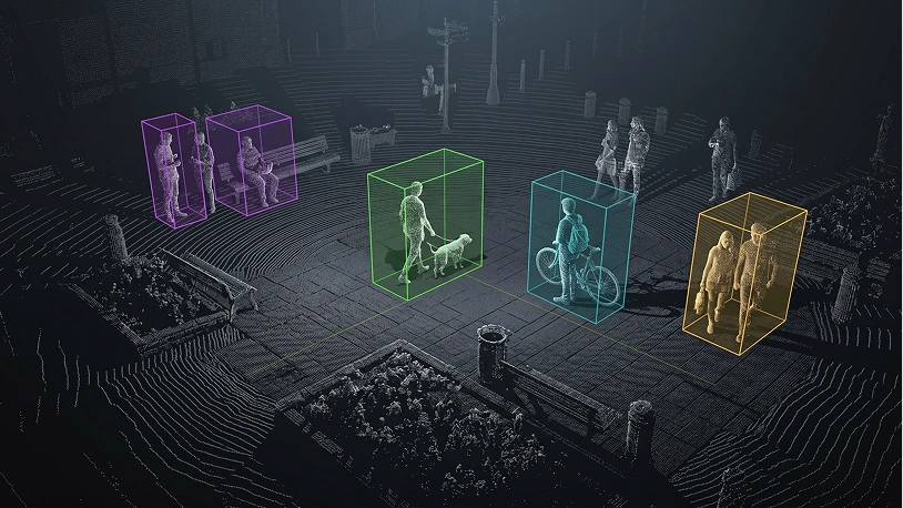
- **Заголовок:** 3D Semantic Segmentation — **Описание:** Each point in the point cloud receives a class label for the object or surface it represents. Classifies parts of three-dimensional spaces, supporting ML models, robotics, and scene understanding. — **Изображение:** 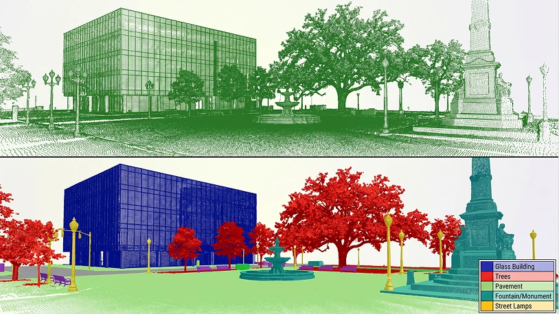
- **Заголовок:** 3D Instance Segmentation — **Описание:** Labels each point in the point cloud while distinguishing between different instances of the same object class. Each instance is uniquely identified, enabling precise object recognition and cloud segmentation. — **Изображение:** 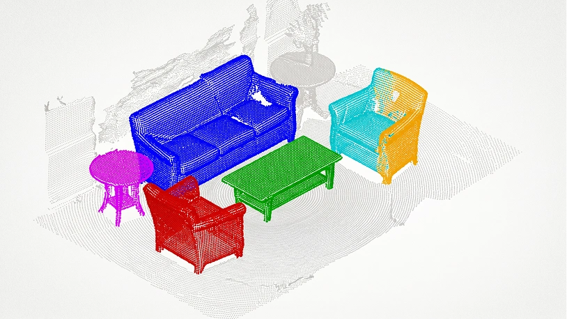
- **Заголовок:** 3D Object Tracking — **Описание:** Identifies and follows object movement across multiple frames in point cloud sequences. Records spatial coordinates, orientation, and trajectory, essential for autonomous vehicles and robotics applications. — **Изображение:** 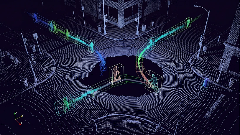
- **Заголовок:** 3D Volume Annotation — **Описание:** Labels volumetric regions within a point cloud, capturing full 3D representations of objects. Useful where understanding complete three-dimensional data and point density is critical for AI models. — **Изображение:** 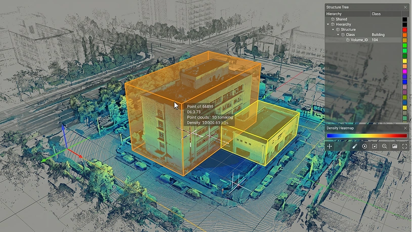
- **Заголовок:** 3D Keypoint Annotation — **Описание:** Marks specific points of interest on objects within a point cloud, such as corners, edges, or joints. Captures spatial information and 3D orientation to support ML models and computer vision tasks. — **Изображение:** 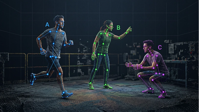
- **Заголовок:** 3D Object Classification — **Описание:** Assigns specific class labels to objects within a point cloud based on geometric shape and spatial orientation. Supports identifying objects and categorizing them across complex three-dimensional spaces. — **Изображение:** 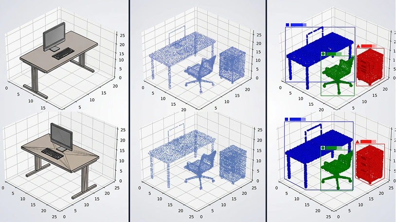
- **Заголовок:** 3D Lane and Road Marking Annotation — **Описание:** Labels lanes, road boundaries, and features in point clouds captured by LiDAR sensors. Provides high-quality training data for autonomous vehicles navigating three-dimensional spaces safely. — **Изображение:** 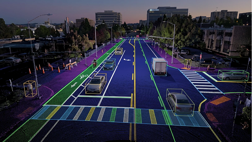
- **Заголовок:** 3D Environment Mapping — **Описание:** Labels entire 3D spaces within a point cloud, including indoor scenes and urban areas. Creates detailed three-dimensional models for navigation, simulation, and high-quality data collection. — **Изображение:** 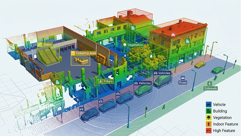
- **Заголовок:** 3D Plane and Surface Annotation — **Описание:** Identifies and labels planar surfaces and geometric shapes within a point cloud, including walls and floors. Delivers spatial information for scene understanding, 3D modeling, and three-dimensional data analysis. — **Изображение:** 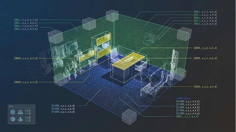
## Заголовок секции Индустрии
Industries
## Перечень индустрий
- **Заголовок индустрии:** Healthcare — **Описание индустрии:** Anatomical 3D reconstruction from scans for surgical planning and precise treatment decisions. — **Изображение индустрии:** 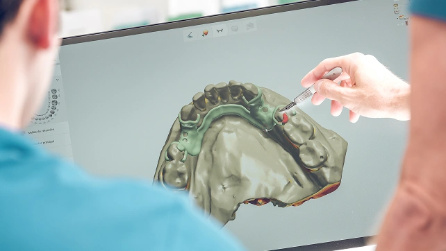
- **Заголовок индустрии:** Automotive — **Описание индустрии:** LiDAR-based environment mapping for real-time navigation and collision avoidance systems. — **Изображение индустрии:** 
- **Заголовок индустрии:** Construction & Architecture — **Описание индустрии:** Accurate building models and site scanning for better planning and resource management. — **Изображение индустрии:** 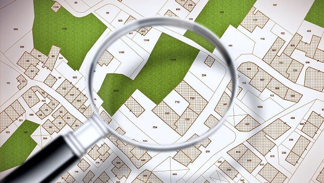
- **Заголовок индустрии:** Real Estate — **Описание индустрии:** Virtual property tours and spatial visualization for immersive remote viewing experiences. — **Изображение индустрии:** 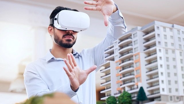
- **Заголовок индустрии:** Security & Surveillance — **Описание индустрии:** 3D environment modeling for enhanced threat detection and real-time monitoring systems. — **Изображение индустрии:** 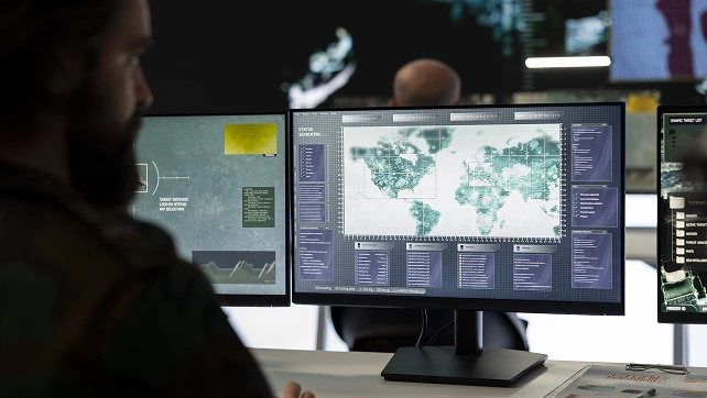
- **Заголовок индустрии:** Manufacturing — **Описание индустрии:** Quality control, defect detection, and predictive maintenance through product scanning. — **Изображение индустрии:** 
- **Заголовок индустрии:** Aerospace — **Описание индустрии:** Aircraft component mapping for design improvement, safety monitoring, and maintenance. — **Изображение индустрии:** 
- **Заголовок индустрии:** Energy & Utilities — **Описание индустрии:** Infrastructure modeling for power plants, pipelines, and predictive maintenance systems. — **Изображение индустрии:** 
## Шаблон CTA - изображение
